Instead of writing a trip report on the Moroccan stretch of my autumn 2017 tour, I thought I’d share a selection of photos. I selected fourteen photos from the 350 photos I took during my time in Morocco. This is one photo for every day in the saddle.
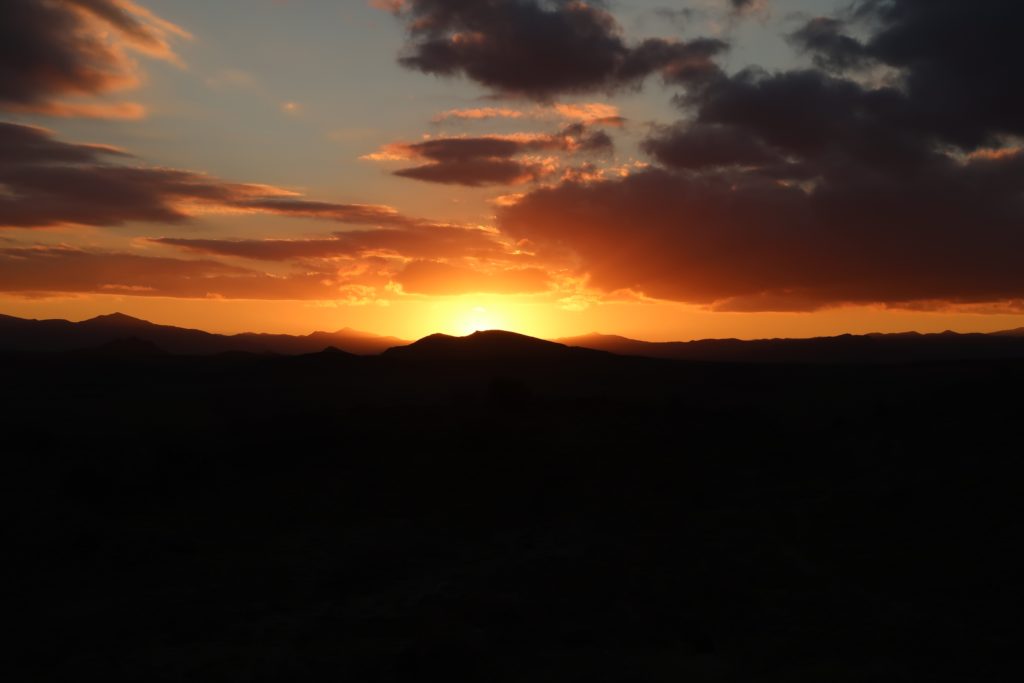
My first night in Morocco treated me to a stunning sunset. The orange light colors the clouds in warm tones. The morning after was pretty chilly though! This photo was taken south of Driouch in North East Morocco.
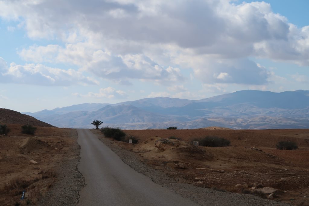
On day two the hills to the North of Taza loomed in the distance. Standing alone on the foreground is a single palm tree.
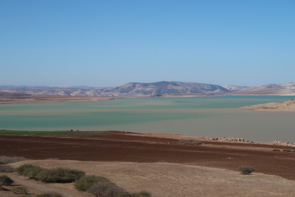
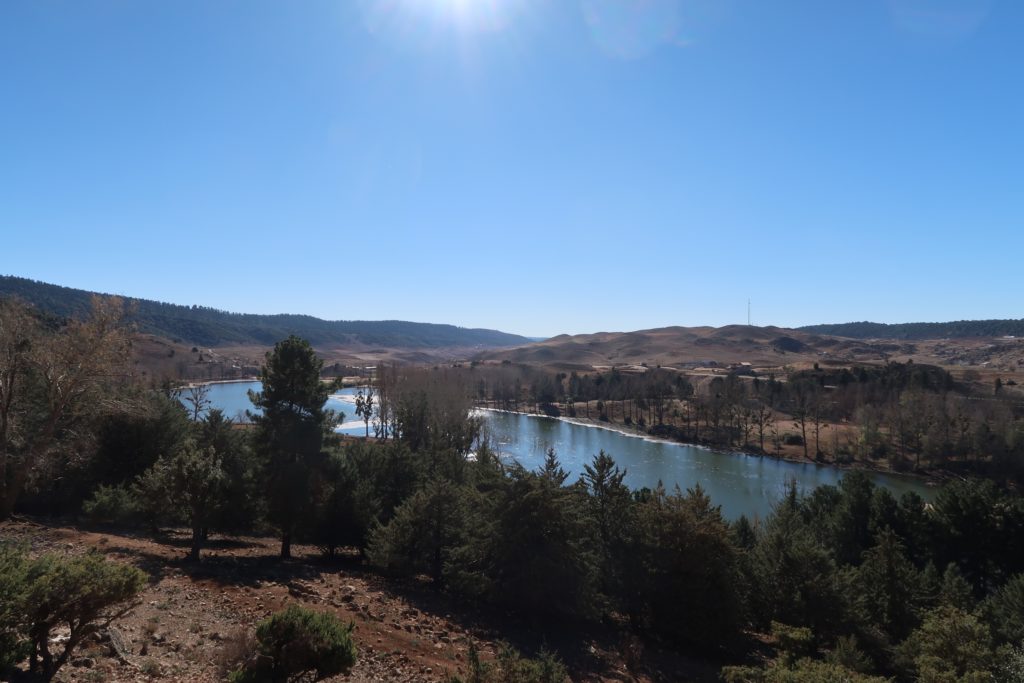
Cycling from Taza to Fes I passed by an artificial lake: the Inaouen basin. A bit further downstream is the Idriss I Dam, which was named after the founder of Morocco. The water level appears to be low.
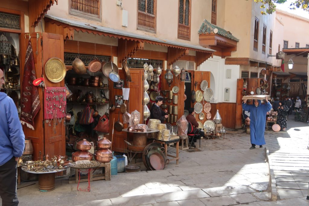
On day four I spent a day exploring the city Fez. Pictured here are merchants selling their copper ware in market stalls that are typical to the medinas found in larger Moroccan cities. These stalls are nicely finished with wood though!
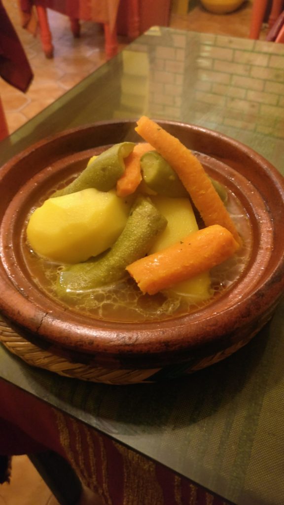
The tajine is a cone shaped pot which is used to cook stews. Pictured here is a vegetable stew, the cone shaped lid is not shown.
Cycling from Ifrane to Khenifra, I passed Lac Ouiouane at an elevation of 1 600 meters in the Middle Atlas. This 122 km day with 1 700 meters of climbing was a nice warm up for what was to follow: the High Atlas.
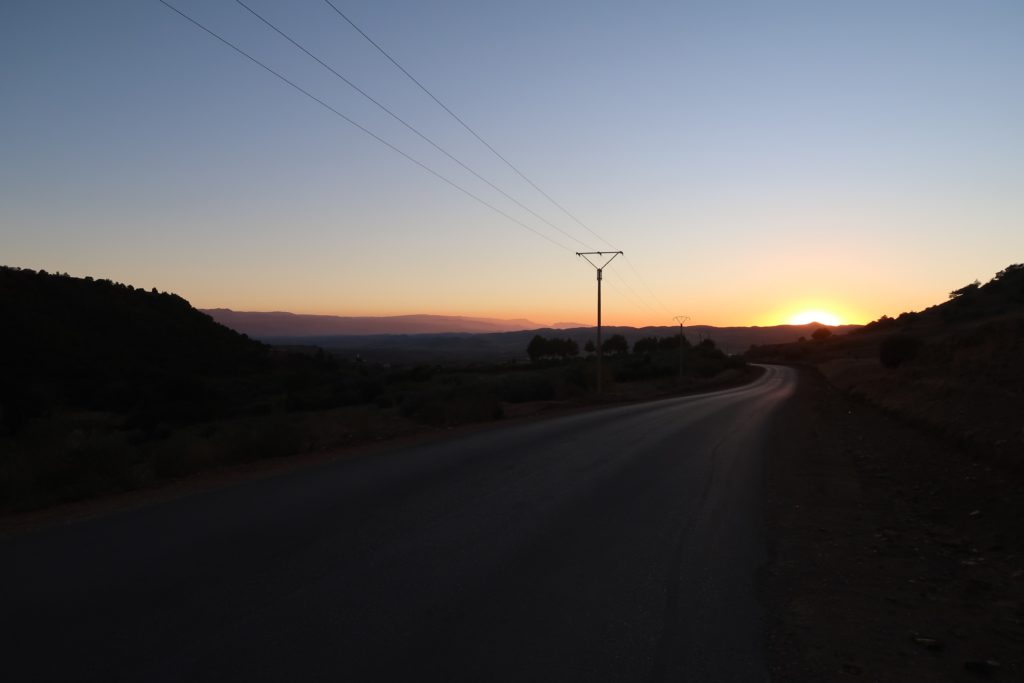
Riding into Khenifra as the sun is setting.
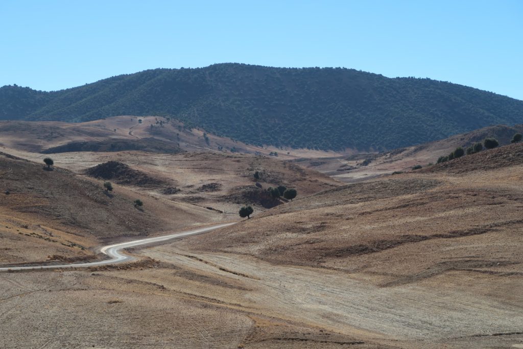
In the mountainous areas of the Atlas, trees appear to grow above a certain altitude. Whether this is due to the moderate climate at this altitude, due to human logging or some other reason I can’t say. This photo taken near to Aghbala in the Béni-Mellal province.
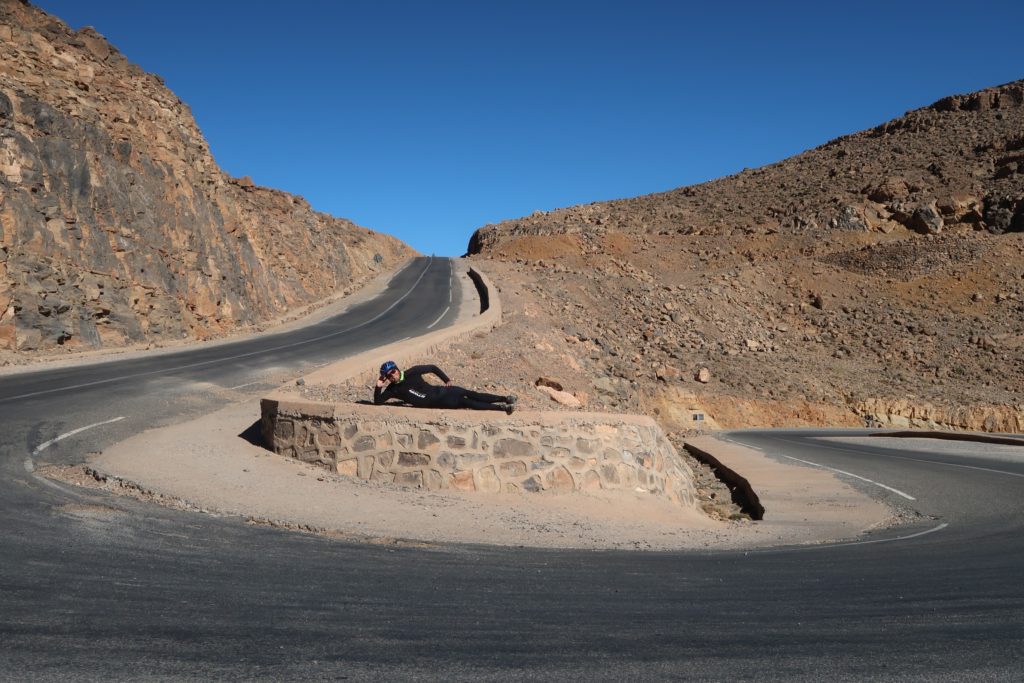
Posing near the top of the Col du Tirherhouzine (2 709 meters). This pass accommodates travel from the North of the High Atlas to the South of the Atlas. I made a video on this section of my trip, you can find it here.
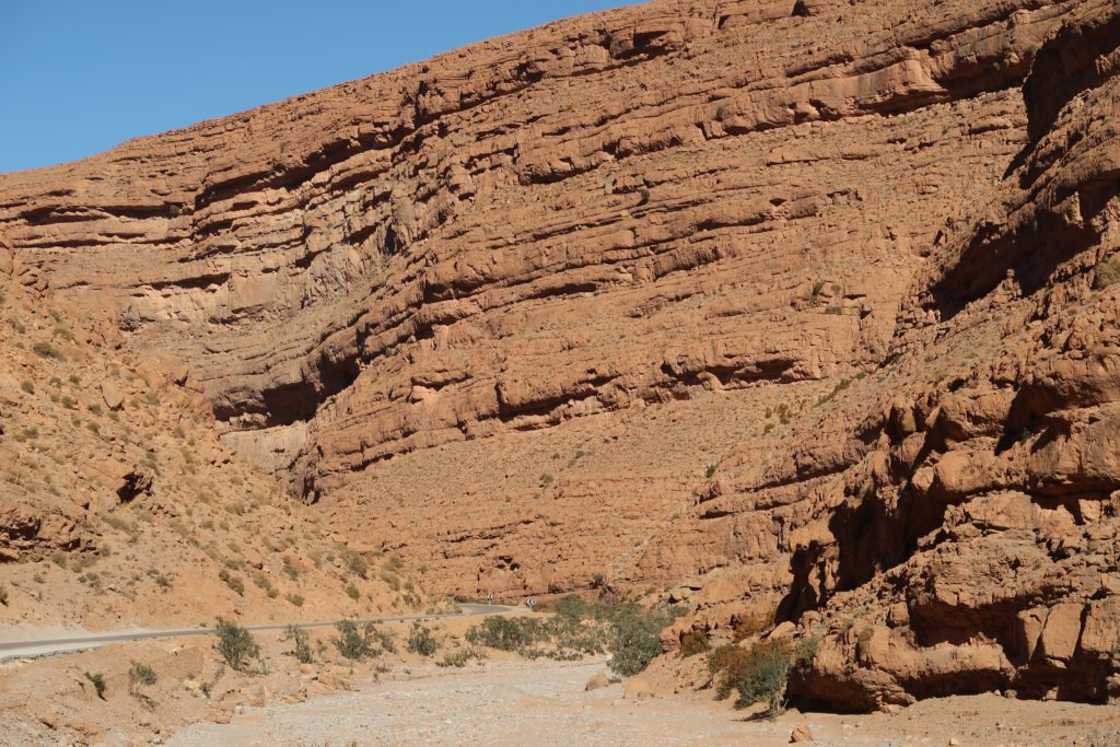
Just before the desert oasis of Tinghir, I cycled through the Todra Gorge. Rock cliffs of over 300 meters tall tower above you on both sides. A little further a stream joins the canyon and the surroundings become much greener. The water feeds a large palm tree forest just outside Tinghir, where dates are farmed.
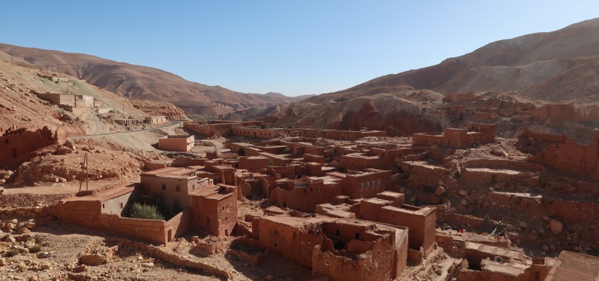
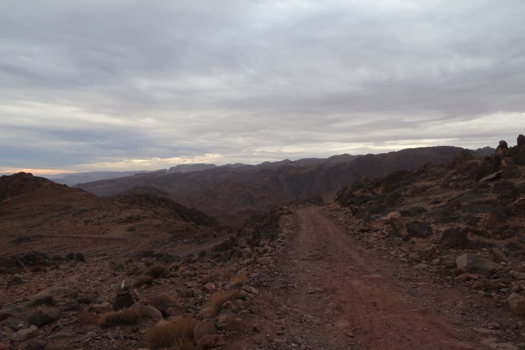
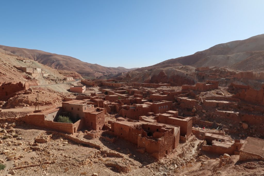
Instead of heading directly to Marrakech from Tinghir, I decided to make a detour via the Jbel Saghro mountain range to Nkob. Here I cycled along my first proper off-road section in Morocco (called a piste). The descend was very rough, resulting in two pinch punctures. This picture is taken near the highest point of the piste. I spent the night some 800 meters below this point. During that night it rained and on the following morning I saw that these mountain tops were covered in snow. I considered myself fortunate not having to descend the piste in snowy conditions!Rather than cycling the direct way from Ouarzazate to Marrakech (N9) it is worth taking the detour via the P1506 to Telouet. Not only is this road much quieter than the national road, you are also treated to this view of a traditional Moroccan village with its mud houses. Closer to Ouarzazate you also pass by Aït Benhaddou, which is an UNESCO World Heritage Site famous for its fortified castles (Ksars).
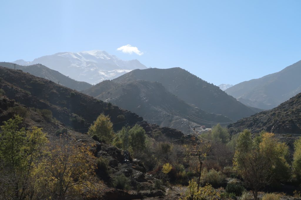
Looking back after the descend towards the Tizi N’Tichka (2260 meters). There was a strong, cold wind blowing on the top that sometimes made cycling impossible. I was happy to be at a warmer elevation :). After the pass I elected to follow the P2016 to Ait Ourir instead of the busy and (frankly) boring N9.
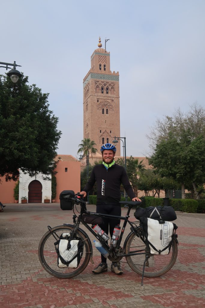
Posing in front of the Koutoubia Mosque in Marrakech. I spent fourteen days traveling the 1 250 km from Melilla to Marrakech, having covered over 17 500 meters of elevation. My flight left four days later, leaving ample time to relax, reflect and explore Marrakech.
2 Replies to “My trip through Morocco in fourteen photos”
Hi, we are due to arrive in Marrakech tonight 9th march. We are heading for Melilla. Is your route good? Or any other? We will need to be in Melilla in 9 days. Any advice greatly appreciated..
Hi Alan, I’d say you’d enjoy my route is you enjoy riding up hills (there’s a fair amount of climbing through the Atlas and anti-Atlas mountains) and the occasional bigger city. There isn’t too much off road in this route, with the exception of the Jbel Saghro stretch. There are fairly long stretches along major roads, like the N9 out of Marakech but that’s a beautiful stretch of road (and a long climb up to Tizi N’Tichka). After the top I’d recommend the quieter road to Telouet. The Todra Gorge was stunning and fairly quiet when I passed through. The section through Jbel Saghro was pretty rough in terms of road surface, with some stretches that were quite challenging for a bicycle (one tyre exploded here when going too fast downhill!). It is one of the sections I recall most vividly three years later :). You might want to consider an alternative if off-roading isn’t to your liking.
Enjoy Morocco, it’s a unique country for two wheeled exploration!
Hi, we are due to arrive in Marrakech tonight 9th march. We are heading for Melilla. Is your route good? Or any other? We will need to be in Melilla in 9 days. Any advice greatly appreciated..
Thanks
Alan
Hi Alan, I’d say you’d enjoy my route is you enjoy riding up hills (there’s a fair amount of climbing through the Atlas and anti-Atlas mountains) and the occasional bigger city. There isn’t too much off road in this route, with the exception of the Jbel Saghro stretch. There are fairly long stretches along major roads, like the N9 out of Marakech but that’s a beautiful stretch of road (and a long climb up to Tizi N’Tichka). After the top I’d recommend the quieter road to Telouet. The Todra Gorge was stunning and fairly quiet when I passed through. The section through Jbel Saghro was pretty rough in terms of road surface, with some stretches that were quite challenging for a bicycle (one tyre exploded here when going too fast downhill!). It is one of the sections I recall most vividly three years later :). You might want to consider an alternative if off-roading isn’t to your liking.
Enjoy Morocco, it’s a unique country for two wheeled exploration!